Saturday, July 25, 2015

Extracting some Geomorphological features from Aerial photograph Vs LIDAR DTM

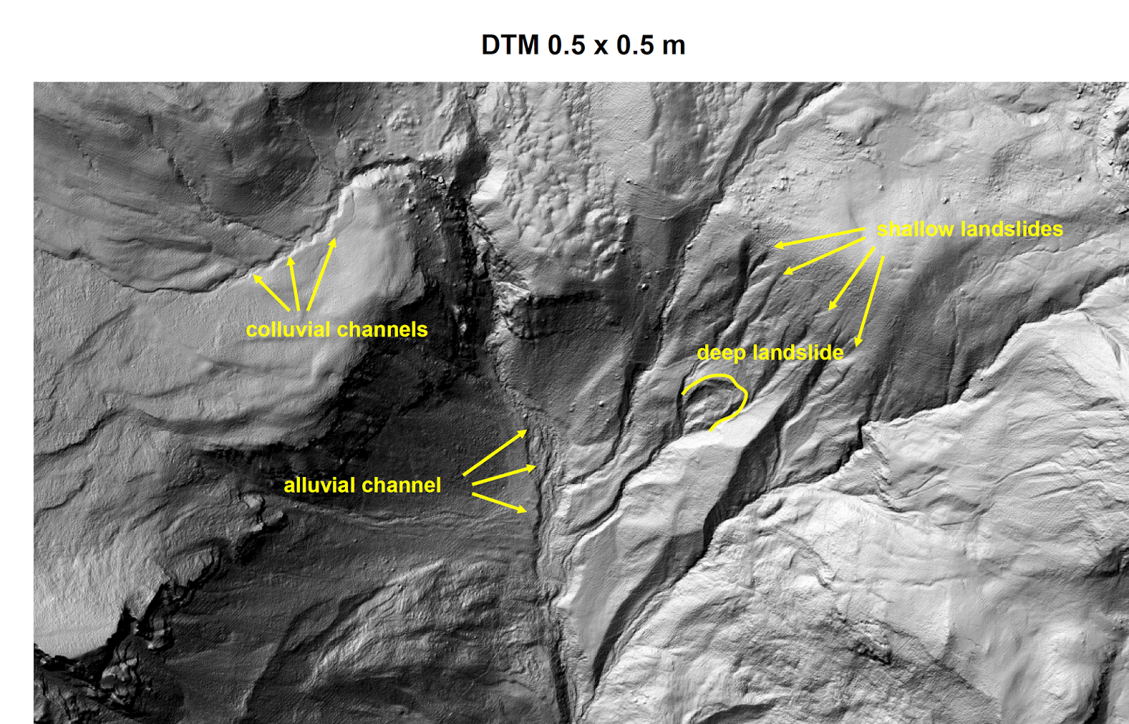
"The effectiveness of high-resolution topography (0.5 m DTM) derived by LIDAR data in the recognition of geomorphological features in the mountainous landscapes (slides courtesy of Paolo Tarolli)".


About Author 


These are slides of a well known presentation he gave in several conferences, seminars, and lectures since 2006. 


Share:

0 التعليقات:

Post a Comment

Blog Directory & Business Pages - OnToplist.com
K.Amen. Powered by Blogger.
Subscribe Via Email

Sign up for our newsletter, and well send you news and tutorials on web design, coding, business, and more! You'll also receive these great gifts:

Science Blog Directory