Sunday, May 31, 2015

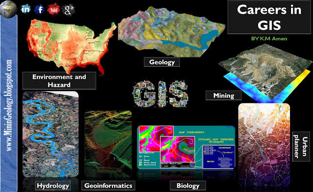
Careers in GIS

Applications of GIS

An urban planner might want to assess the extent of urban fringe growth in her/his city, and quantify the population growth that some suburbs are witnessing. S/he might also like to understand why these particular suburbs are growing and others are not.

A biologist might be interested in the impact of slash-and-burn practices on the populations of amphibian species in the forests of a mountain range to obtain a better understanding of long-term threats to those populations.

A natural hazard analyst might like to identify the high-risk areas of annual monsoon-related flooding by investigating rainfall patterns and terrain characteristics.

A geological engineer might want to identify the best localities for constructing buildings in an earthquake-prone area by looking at rock formation characteristics.

A cartographer Map maker and designing digital maps.

A mining engineer could be interested in determining which prospective Ore Deposits should be selected for future exploration, taking into account parameters such as extent, depth and quality of the ore body, amongst others.

A geoinformatics engineer hired by a telecommunications company may want to determine the best sites for the company’s relay stations, taking into account various cost factors such as land prices, undulation of the terrain et cetera.

A forest manager might want to optimize timber production using data on soil and current tree stand distributions, in the presence of a number of operational constraints, such as the need to preserve species diversity in the area.

A hydrological engineer might want to study a number of water quality parameters of different sites in a freshwater lake to improve understanding of the current distribution of Typha reed beds, and why it differs from that of a decade ago.
Share:

Veladero Gold Mine

Veladero Gold Mine

Location: The Veladero mine is located in the San Juan province of Argentina, immediately to the south of the Pascua-Lama property, in the highly prospective Frontera district.
Controlling Company: Barrick Gold (100%).
Brief History: The deposits at Veladero mine were discovered in 1997. However, development of the mine only started in 2002, with production beginning in 2005.
Brief Overview: Barrick’s Veladero mine has helped trigger a remarkable economic turnaround in Argentina’s San Juan province, according to a recent study. Between 2004 and 2011, the province’s unemployment rate fell 36 percent, and per capita income surged 177 percent to $5,260 from $1,900. Exports jumped 12-fold to $2.5 billion from $211 million, and the province’s manufacturing sector grew at an average annual rate of 13.5 percent, twice the national average.
“Veladero has made an enormous economic contribution in San Juan,” says Alfredo Lasalvia, lead author of a study by the Universidad Tecnológica Nacional (UTN) that measured Veladero’s socioeconomic impact on San Juan. “Economic growth in San Juan outpaced every other province in Argentina between 2007 and 2010, and Veladero played a big part in that. We estimate the mine contributes about 34 percent to San Juan’s GDP.”
Veladero is located in northeast San Juan more than 4,000 meters above sea level. It is the second largest private sector employer in the province (Barrick’s Pascua-Lama project is the largest) with about 3,500 workers, 85 percent of whom are from San Juan. The mine, which went operational in 2005, produced 766,000 ounces of gold in 2012.
The economic impact of Veladero has manifested itself in a myriad of ways, including payment of taxes and royalties, hiring of local residents, and procurement of goods and services in San Juan and other parts of Argentina. In 2005, Veladero paid just $513,000 in royalties to the San Juan government, according to the UTN study. By 2011, royalty payments totaled $48 million and accounted for 86 percent of all royalties collected by the San Juan government.
In 2011, Veladero spent $428 million on goods and services in Argentina, including $190 million in San Juan alone. “veladero generates numerous opportunities for suppliers in San Juan, which leads to the creation of new companies and the growth of existing ones,” Lasalvia says. “That means more jobs are being created, which puts more money in peoples’ pockets, which drives economic activity in the province.”
Brief Description: The Veladero mine currently produces ore from two pits, with an expected minimum mine life of 16 years. Geology/Mineralisation: The Veladero mine property contains several large deposits of gold and silver mineralisation in altered, silicified volcanic rock, and various types of silicified breccia.
Main-stage mineralisation is superimposed on the Miocene volcanic vent complex of diatreme breccias, associated pyroclastic rocks, flow domes, and porphyry intrusions.
Reserves: Proven and probable mineral reserves as at December 31, 2013, were 5.1-million ounces of gold.
Products: Gold.
Mining Method: Veladero is a conventional openpit operation. Major Infrastructure and Equipment: Ore is crushed using a two-stage crushing process and transported by overland conveyor and trucks to the leach pad area. Run-of-mine ore is trucked directly to the valley-fill leach pad.

Prospects: Gold production in 2014 is expected to be 650 000 oz to 700 000 oz, reflecting increased recovery of leached ounces and higher grades from the Argenta and Filo Federico pits.


Veladero  Gold Mine

Share:

Beautiful Rocks in Italy


What is Pyrite?

Pyrite is a brass-yellow mineral with a bright metallic luster. It has a chemical composition of iron disulfide (FeS2) and is the most common sulfide mineral. It forms at high and low temperatures and occurs, usually in small quantities, in igneous, metamorphic and sedimentary rocks worldwide.

The name "pyrite" is after the Greek "pyr" meaning "fire." This name was given because pyrite can be used to create the sparks needed for starting a fire if it is struck against metal or another hard material. Pieces of pyrite have also been used as a spark-producing material in flintlock firearms.

Pyrite has a nickname that has become famous - “Fool’s Gold.” The mineral's gold color, metallic luster and high specific gravity often cause it to be mistaken for gold by inexperienced prospectors. However, pyrite is often associated with gold. The two minerals often form together, and in some deposits pyrite contains enough included gold to warrant mining.

Identifying Pyrite

Hand-specimens of pyrite are usually easy to identify. The mineral always has a brass-yellow color, a metallic luster and a high specific gravity. It is harder than other yellow metallic minerals and its streak is black, usually with a tinge of green. It often occurs in well-formed crystals in the shape of cubes, octahedrons or pyritohedrons, which often have striated faces.

The only common mineral that has properties similar to pyrite is marcasite, a dimorph of pyrite with the same chemical composition but an orthorhombic crystal structure. Marcasite does not have the same brassy yellow color of pyrite. Instead it is a pale brass color, sometimes with a slight tint of green. Marcasite is more brittle than pyrite and also has a slightly lower specific gravity at 4.8.

Pyrite and gold can easily be distinguished. Gold is very soft and will bend or dent with pin pressure. Pyrite is brittle and thin pieces will break with pin pressure. Gold leaves a yellow streak, while pyrite's streak is greenish black. Gold also has a much higher specific gravity. A little careful testing will help you avoid the "Fool's Gold" problem.

Uses of Pyrite?

Pyrite used to be an important ore for the production of sulfur and sulfuric acid. Today most sulfur is obtained as a byproduct of natural gas and crude oil processing. Some sulfur continues to be produced from pyrite as a byproduct of gold production.

The most important use of pyrite is as an ore of gold. Gold and pyrite form under similar conditions and occur together in the same rocks. In some deposits small amounts of gold occur as inclusions and substitutions within pyrite.

Some pyrites can contain 0.25% gold by weight or more. Although this is a tiny fraction of the ore, the value of gold is so high that the pyrite might be a worthwhile mining target. If pyrite contains 0.25% gold and the gold price is $1500 per troy ounce, then one ton of pyrite will contain about 73 troy ounces of gold worth over $109,000. That is not a guaranteed money-maker. It depends upon how efficiently the gold can be recovered and the cost of the recovery process.


Pyrite is occasionally used as a gemstone. It is fashioned into beads, cut into cabochons, faceted, and carved into shapes. This type of jewelry was popular in the United States and Europe in the mid- to late-1800s. Most of the jewelry stones were called "marcasite," but they are actually pyrite. (Marcasite would be a poor choice for jewelry because it quickly oxidizes, and the oxidation products cause damage to anything that they contact. Pyrite is not an excellent jewelry stone because it easily tarnishes.)
Share:

Friday, May 29, 2015

Rocks around the World

Rocks around the World

Share:

Kalgoorlie Superpit Gold Mine

Kalgoorlie Superpit Gold Mine

The Australia's largest open cut gold mine


Location: Kalgoorlie, Western Australia.
Products: Gold.
Owner: Kalgoorlie Consolidated Gold Mines Pty Ltd.
Overview: The Super Pit is located off the Goldfields Highway on the south-east edge of Kalgoorlie, Western Australia. The pit is oblong in shape and is approximately 3.5 kilometres long, 1.5 kilometres wide and 570 metres deep. At these dimensions, it is large enough to be seen from space.
The Super Pit is owned by Kalgoorlie Consolidated Gold Mines Pty Ltd, a company owned 50/50 by Barrick Gold Corporation and Newmont Mining Corporation. The mine produces 850,000 ounces (28 tonnes) of gold per year, and employs around 550 employees directly on site.
Originally consisting of a number of small underground mines, consolidation into a single open pit mine was attempted by Alan Bond, but he was unable to complete the takeover. The Super Pit was eventually created in 1989 by Kalgoorlie Consolidated Gold Mines Pty Ltd.
Barrick Gold acquired its share of the mine in December 2001, when it took over Homestake Mining Company. Newmont became part-owner of the mine three months later, when it acquired Normandy Mining in February 2002.
Geological Setting: Most of the good gold mined in the Super Pit occurs within ore lodes formed by ancient shears in a rock unit called the Golden Mile Dolerite. The gold mining area of Kalgoorlie-Boulder-Fimiston has long been called the Golden Mile because of the geographical concentration of rich mines in that area, even though the lodes occur in an area over 2 km in width and 1 km in depth.

Kalgoorlie Terrane.
1. Pre- to syn-D, granitoids were emplaced as broadly conformable sheet-like bodies at the base of, or within, the greenstone succession, probably during
2. Post-D, to syn-D, granitoids were diapirically emplaced, and are concentrated in a zone along the western side of the Kalgoorlie Terrane.
3. Late-tectonic to post-tectonic granitoids were emplaced late in the history of the Terrane. Limited geochronological data suggest the granitoids were emplaced at 2690-2680 Ma (group I), 2665-2660 Ma (group 2) and 2650-2600 Ma (group 3) (Hill ef al.,
1992). Small porphyry intrusions, including lamprophyres
(Rock et aL, 1989), are widespread and petrologically diverse; they may be genetically related to some of the I-type granitoid suites (Witt, 1992). They are common in and near regional deformation zones, and are associated with many gold deposits (Perring et al., 1988,1989).
GOLD MINERALIZATION:
All rock types in the Kalgoorlie Terrane host gold mineralization, but most production has come from fractionated quartz-dolerite zones of mafic-ultramafic sills and from tholeiitic basalt.
The dominance of quartz-dolerite and tholeiitic basalt remains even if bias introduced by the "giant" Kalgoorlie deposits (Golden
Mile, Mount Charlotte) is eliminated. A similar picture emerges when host rocks to gold mineralization throughout the Yilgarn Craton are considered (.1B; Groves & Barley, 1988). Quartz-dolerite and tholeiitic basalt host rocks are characterized by high FeO* contents and FeO*/(FeO*+MgO) (Tables II.1,11.2), where FeO* is total iron expressed as FeO. Although mafic rocks are the dominant hosts, other rock types (e.g., granitoids, porphyry, ultramafic rocks) host important deposits, and can even be the dominant host rock on a camp scale (e.g., porphyries at New Celebration). All rock types in the Kalgoorlie Terrane host gold mineralization, but most production has come from fractionated quartz-dolerite zones of mafic-ultramafic sills and from tholeiitic basalt .
Production:
Mining is via conventional drill and blast mining via face shovels and dump trucks. Around 15 million tonnes of rock is moved in any given year, consisting primarily of waste rock.

Gold within the Golden Mile lode system is unusual in that it is present as telluride minerals within pyrite. In order to recover the gold, the ore must be crushed, passed through a gravity circuit to recover the free gold present in some of the higher-grade lodes, and then subjected to flotation to produce an auriferous pyrite concentrate. This is then roasted at a small smelter outside Kalgoorlie-Boulder to liberate the gold from the tellurides, with doré bars poured.

More information and resources 
Share:

Thursday, May 28, 2015

Building a GIS Career


The use of geospatial technologies is increasingly being used in a variety of fields.  GIS is being used in many different industries and the skills required to be a successful GIS professional have evolved over the years.  Below are recommendations on building a strong background in preparation for a career in GIS based on what the majority of employers are looking for.  However, keep in mind you will find a wide variety of work and educational backgrounds among those working in GIS jobs.  This post is a work in progress and will be updated as new skills and achievements are identified as being essential for developing a successful GIS career.

The starting point in building a successful career in GIS is a solid education. This involves taking classes in cartography, GIS, spatial analysis, database management, web technologies, and programming.  There are a lot of GIS certificate courses emerging that help solve the confusion as to which classes to take, but any department offering GIS coursework is a great starting point. Start by taking a general “what is GIS” themed course. This is important because it is important to understand the general concepts in GIS before actually attempting some of the functionality. Taking a good cartography course is critical as well. Often overlooked by many seeking GIS knowledge, a comprehension of cartographic techniques is especially important for understanding mapmaking and for learning how to create maps that are effective in communicating geographic data. The end process of visualizing spatial analysis can be tricky. Understand the methods by which one can display data is essential to effectively communicating with maps.


Most employers strongly prefer at least a bachelor’s degree.  Depending on the industry of the job listing, that degree would preferably be in Geography, Computer Science, Engineering, or Urban Planning.  Job seekers that have a bachelor’s degree in another major should supplement their college education with a certificate program.  Those striving for managerial positions in GIS will be more successful if they also have a master’s degree.

Learning GIS Software Applications
The next step is to take coursework that applies the concepts of GIS and cartography. These courses are always software specific so it’s important to choose a class that teaches the software you will be using once employed. Currently, ESRI products dominate about 70% of the GIS software market with MapInfo the nearest competitor. If you are unsure which software to learn, I suggest learning about ESRI’s ArcGIS suite of software, as these are the software applications most often required by employers. You can also do a job search of companies and agencies in the area you want to work in to see what GIS software they are requiring for employment. Classes specific to a GIS software package can be taken at most universities and colleges, through satellite courses from the software companies themselves, or through online or distance learning. ESRI offers free modules online for many introductory courses to their products.

The Next Level
The current trend in GIS is customization and application. More and more GIS packages are being altered to serve a specific GIS purpose. This could range from an Emergency Response System to an application customized to allow a user to generate mailing lists based on a spatially selected area. Many of the software packages contain some ability for customization using programming languages. The type of language will be affected by the software application. There are two different areas of customization: desktop applications and browser based applications. For the browser based mapping applications, understanding the various web-based languages such as HTML, Javascript, ASP and so forth is critical.

Since GIS analysis is involves the integration of spatial and tabular data, some knowledge of relational database management (RDBMS) is a must. Taking a class in SQL (structured query language) is important to mastering RDBMS and understanding structured query language (SQL).

Getting GIS Experience
As with all fields, nothing beats real-world experience. Internships are extremely popular in GIS as they allow the employer a cheap source of labor for lower level GIS tasks and, in turn, provide a valuable training experience for the intern. The only way to truly become proficient in GIS is to simply use it. The coursework will only serve to provide a base knowledge of the field and without some form of practical experience, most companies will not be interested in hiring. To find internships check with your school’s geography or urban planning department. Oftentimes companies and agencies looking for student help will advertise there. You can also directly inquire with places that you are interested in working for. Internships can lead to full-time positions.

Finding a GIS Job
Once you’ve completed your coursework and gotten hands on work experience, where do you look for a job? There are quite a few job sites on the internet specializing exclusively in GIS employment opportunities. So write up a resume and cover letter and hit the internet. Aim for jobs that meet your education and experience level. In general, the hierarchy and required GIS experience for hands-on (i.e. non-managerial) positions is as follows:

GIS Intern
Almost every higher level (Technician, Analyst, etc.) position will require some hand-on job training.  The best way to achieve this is through an internship.  Internships are mostly low-paying, part-time jobs but they are the best way to get further GIS training and to develop your GIS skills in a real world setting.  Learning GIS out of a textbook is a great way to get started, but in reality, few GIS tasks are solved as neatly as the “follow steps 1-10 of your workbook.  Getting an internship has become more competitive in recent years.  To be a competitive candidate for an internship, only apply once you’ve taken a solid groundwork of GIS courses especially an “Introduction to GIS” class, a second advance GIS class, a separate cartography class (if available), and a class covering databases.  While an internship provides on-the-job training, you will mostly be expected to learn on your own so it’s important to already have a good baseline to start from.

GIS Technician/Specialist
1-2 years hands on experience with GIS based software. If you first took an internship you should be able to aim for these types of jobs. The job titles Technician and Specialist tend to be used interchangeably.  They are both journey level positions.  GIS Technicians should have a solid grasp on the most common GIS tasks.  Examples of those are: the ability to edit vector data, create data in a GIS software application from a multitude of sources (paper documents, Excel files, hand written maps, etc.), be able to work with external databases (such as Access and SQL Server) including understanding structured query language (SQL), understand projections and coordinate systems, work with GPS receivers to collect data, and  strong cartographic design skills.   While it’s not the only software package out there, a good majority of GIS positions are looking for proficiency in ArcGIS.  Having a good grasp on working with KML and KMZ files is also critical as some companies are using Google Maps and Google Earth for some tasks. Common tasks involve cartographic output (mapmaking) and data manipulation. A lot of positions are also starting to look for some basic programming experience.

GIS Analyst
At least 2-3 years experience with GIS based software. At this level you should be performing more complex analyses and RDBMS. In addition, an analysts should also be primarily concerned with application development and should have a fair amount of programming experience (see Learning Programming for GIS). For example, if you work with Esri’s ArcGIS software, python and SQL will be needed.  Analysts, having built on their skills developed as a GIS Technician, should have strong skills in cartographic design, analytical geography, database design and management, programming, project management, and communication (including strong writing skills).  Supervisory responsibilities and project management are also common responsibilities with the Analyst supervising technicians and interns.  There is also a growing demand by employers for Analysts to be knowledgeable about open source GIS.

GIS Coordinator or Manager
Depending on the company or agency, usually the manager has at least 5-6 years of experience in the field. The manager would also be required to have budgetary and project management experience. Depending on the size of the staff, this position may or may not also involved technical responsibilities. At the executive level, having a GIO, a Geographic Information Officer, is emerging as a new position in the GIS field. A GIO is a counterpart to the traditional CIO, Computer Information Officer.

Share:

Wednesday, May 27, 2015

Twin Creeks Mine

Twin Creeks Mine
Twin Creeks Mine


Location: Northern Nevada, United States.
Products: Gold.
Owner: Newmont.
Deposit size: Length  4    km
                        Width    1     km
                        Area      3     sq km

Deposit features: Beds or lenses
                                Dikes or sills

                                Fault zone
Deposit age geologic: Eocene
Intrusive rock:  Dacite porphyry
Ore bearing unit: Pennsylvanian–Permian Etchart Fm.; Ordovician                      Valmy Fm. and Comus Fm.
Ore bearing unit thickness: 3000 m
Tectonic setting: North-American craton rifted western margin, imbricate structure.
Alteration : Contact metamorphism (?) decarbonatization, oxidation & silicification (jasperoid)
Associated deposits: sediment-hosted Au
Discovery date: 1984
Operation types: Open pit, Crushing and milling & Heap leach.
Total tonnage:   223.4tonnes
Contained gold: 484 tonnes
Recovery:  Au 80%
Gold grade: 2.67 g/t
Reserves (December 31, 2014): 0.158M oz. gold

Twin Creeks Mine

BY -Dr.R.N.Mishra-
Nevada is one of the most important metal-mining States of the West and has produced large quantities of gold, silver, and lead. At present her production of precious metals is again rising rapidly, and although the output of lead is much smaller than formerly the State is now an important producer of copper. The mining districts number about 200.


The northern boundary line of Nevada lies within the province of the Columbia River lava, and these flows of basalt and rhyolite extend for some distance into the State. At the bend of the California State line the Sierra Nevada forms the boundary of Nevada and a small part of that great range is included within its limits.
TWIN CREEKS MINE has Sediment-hosted gold deposit in Nevada, U.S.A. The USGS recognised the deposit as Carlin Subtype, manifested as Beds or lenses, Dikes or sills or of Fault zone kind of mineralisation. The Twin Creek Deposit has been surveyed and the dimensions are 4 km long x 1 km wide with an area of 3 sq.km. Generally, The Carlin–type deposits represent some of the largest hydrothermal gold deposits in the world.

The Carlin type deposits show enrichment in the elements gold, antimony, mercury, thallium and barium. This enrichment is created by hydrothermal circulation with a temperature of up to 300 °C. The underlying rocks out of which the minerals are dissolved are normally silty carbonates, although also silicates and other sediments are possible. The material in the deposit is altered in a way that the carbonate minerals are either dissolved or converted to the silicates by silicate rich hydrothermal water. For example dolomite is transformed into jasperoid. Another alteration is the formation of clay minerals by interaction of water and feldspar.

-Dr.R.N.Mishra-

Reference information
Bloomstein, E.I., Massingil, G.L., Parratt, R.L., and Peltonen, D.R., 1991, Discovery, geology, and mineralization of the Rabbit Creek gold deposit, Humboldt County, Nevada, in Raines, G.L., Lisle, R.E., Schafer, R.W., and Wilkinson, W.H., eds., Geology and ore deposits of the Great Basin, Symposium Proceedings: Reno, Geological Society of Nevada, p. 821–843.
Breit, F.J., Jr., Ressel, M.W., Anderson, S.D., and Muirhead, E.M.M., 2005, Geology and gold deposits of the Twin Creeks mine, Humboldt County, Nevada, in Rhoden, H.N., Steininger, R.C., and Vikre, P.G., eds., Symposium 2005—Window to the world: Reno, Nevada Geological Society, p. 431–451.
Briggs, D.F., 2006, Mining operations report, version 2005: Unpublished.
Groff, J.A., Heizler, M.T., McIntosh, W.C., and Norman, D.I., 1997, 40Ar/39Ar dating and mineral paragenesis for Carlin-type gold deposits along the Getchell Trend, Nevada—Evidence for Cretaceous and Tertiary gold mineralization: Economic Geology, v. 92, p. 601–622.
Hall, C.M., Kesler, S.E., Simon, G., and Fortuna J., 2000, Overlapping Cretaceous and Eocene alteration, Twin Creeks Carlin-type deposit, Nevada: Economic Geology, v. 95, p. 1739–1752.
Nevada Bureau of Mines and Geology, 2011, The Nevada mineral industry, 2010: Nevada Bureau of Mines and Geology Special Publication MI-2010, 151 p.
Newmont, 2012, Reserves and non-reserve mineralization: Annual Report of December 31, 2011, 8 p., last accessed May 8, 2012, at http://www.newmont.com/sites/default/files/u87/NEM_2011%20Attributable%20Reserves%20and%20NRM.PDF.
Osteberg, M.W., and Guilbert, J.M., 1991, Geology, wall-rock alteration, and new exploration techniques at the Chimney Creek sediment-hosted gold deposit, Humboldt County, Nevada, in Raines, G.L., Lisle, R.E., Schafer, R.W., and Wilkinson, W.H., eds., Geology and ore deposits of the Great Basin, Symposium Proceedings: Reno, Geological Society of Nevada, p. 805–819.
Simon, G., Kesler, S.E., and Chryssoulis, S., 1999, Geochemistry and textures of gold-bearing arsenian pyrite, Twin Creeks, Nevada—Implications for deposition of gold in Carlin-type deposits: Economic Geology, v. 94, p. 405–422.
Stenger, D.P., Kesler, S.E., Peltonen, D.R., and Tapper, C.J., 1998, Deposition of gold in Carlin-type deposits—The role of sulfidation and decarbonation at Twin Creeks, Nevada: Economic Geology, v. 93, p. 201–215.
Thoreson, R.F., Jones, M.E., Breit, F.J., Doyle-Kunkel, M.A., and Clarke, L.J., 2000, The geology and gold mineralization of the Twin Creeks gold deposits, Humboldt county, Nevada, in Crafford, A.E.J., ed., Geology and ore deposits—The Great Basin and beyond; Geology and ore deposits of the Getchell region, Humboldt County, Nevada: Geological Society of Nevada Symposium 2000, Field Trip 9, p. 85–111.
Share:

Monday, May 25, 2015

What Does it Cost?

Exploration & Mining from Ore to Metal …. What does it Cost?!!


Exploration & Mining from Ore to Metal …. What does it Cost?!!

A Comment by 


Usually 5 years of a company's time the financial cost depends on 
what you are looking for, where your are looking and what you end up finding?
Share:

Saturday, May 23, 2015

Mineral Policy of Australia

Australia

Australia

The commonwealth of Australia is a highly developed country with world’s seventh highest per capita income. The country is comprised of mainland, Australian continent (7.618 million km2 surface area), surrounded by more than 8000 islands in Indian and Pacific Ocean that includes Tasmania (68,000 km2). The population is estimated to be 22.70 million as on 2011. Australia follows constitutional monarchy with federal parliamentary system of government with Queen Elizabeth II at its apex. Australia has six states and two major mainland territories.

The mineral resource base industries are the key pillar of Australian economy. Australia is the world’s leading producer of bauxite (65 Mt) and iron ore (393.9 Mt), the second largest producer of alumina (19.6 Mt), lead (0.57 Mt) and manganese (4.45 Mt), the third of brown coal (66 Mt), gold (~250 t), nickel (185 kt), zinc (1.29 Mt) and uranium (1.224 Mt U), the fourth of aluminum (2 Mt), black coal (445 Mt) and silver (1.63 kt), and finally the fifth largest producer of tin during 2009.

The mineral policy and mining legislation are largely provincial. Mines and minerals are a state subject in Australia and hence each of the six states and two major territories has their own mining legislation. Although there are many similarities, differences in legislation from state to state are also very significant. The policy framework and Acts are powerful with clarity, efficiency and competitive in the process to make the fortune. But the system is quite complex on certain issues.
The legislation as framed in Western Australia can be considered as model for discussion, with some deviation from other states and territories. The Act may be cited as Mining Act 1978 and updated
2009. The mining tenement or concession includes PL, exploration license, retention license, ML, general purpose lease and miscellaneous license granted or acquired under this Act or by virtue of the repealed Act. The Act includes the specified piece of land in respect of which the tenement is so granted or acquired. The application for all types of license in prescribed format is to be submitted to the office of the mining registrar or warden of the mineral field or district in which the largest portion of the land to which the application relates is situated. The application must be accompanied by the following documents.
(a) Written description of the area.
(b) A map with clearly delineated tenement boundaries and coordinates.
(c) Detail program of work proposal.
(d) Mining proposal or mineralization report prepared by a qualified person.
(e) Estimated amount of money to be expended.
(f) Stipulated fee and the amount of prescribed rent for the first year or portion thereof.
The mining registrar may grant the license if satisfied that the applicant has complied in all respects with the provisions of this Act or refuse the license if not so satisfied. The holder of prospecting and exploration license will have priority for grant of one or more mining or general purpose leases or both in respect of any part or parts of the land while the license in force. The license and lease are transferable.
Western AustraliadTenement Type Summary (2009)

A Comment By 


In recent years all Mining title applications are required to submit a full EIS. The process of undertaking an EIS can take up to three years and cost around $3M. There are not too many juniors out there who can commit such resources before getting into production. Take out the juniors who initiate 90% of new projects and very soon Australian mining will become a duopoly. Our Industry is being killed off by gutless politicians and self serving civil servants; it is well past the time to protest.


Operating Mines in Australia are about 421 mines and project


Share:
Blog Directory & Business Pages - OnToplist.com
K.Amen. Powered by Blogger.
Subscribe Via Email

Sign up for our newsletter, and well send you news and tutorials on web design, coding, business, and more! You'll also receive these great gifts:

Science Blog Directory